The Environment Agency – Abu Dhabi Undertakes a Hydrogeological Mapping Project in the UAE to Prepare Digital Maps, Utilizing Geographical Information Systems
Abu Dhabi, 4th February 2022: The Environment Agency – Abu Dhabi (EAD), in cooperation with the Ministry of Energy and Infrastructure, is conducting a hydrogeological mapping project for the UAE- a unique project at the level of the Arabian Gulf region. The project aims to collect, classify, and analyse all available data on ground and surface water, which has been collected from well drilling, research, and reports. This information will be converted into digital data that can be utilised in preparing high-quality, accurate digital maps, using Geographical Information Systems (GIS).
The information covers ground water, well locations, geological and topographical data, land use, surface water, such as ponds, dams and springs, in addition to plant cover and soil. The data is categorised and interpreted to identify gaps and provide missing information. This is achieved through field tests and measurements such as pumping tests on selected wells as well as gathering data on ground water levels. Also measured is water salinity and chemical, biological, and radioactive characteristics and other surface geological information and land use, in addition to climate data.
Maps are produced with different drawing scales to determine the types and dimensions of the groundwater aquifers. The maps also determine depths and storage capacity, and locations of withdrawal and recharging of these reservoirs. The information also helps to identify the aquifers subject to depletion, salinization, due to increased abstraction, and the extent of pollution to these aquifers. This is in addition to causes of pollution and many other characteristics that can be displayed in the form of maps.
The information enables decision-makers in the country to have a correct understanding of the current situation of groundwater aquifers. This further facilitates taking appropriate measures, procedures, and policies to exploit these aquifers sustainably using available groundwater resources, which protects them from depletion and pollution, and optimally planning for more effective land use. The hydrogeological map of the UAE will also help determine the locations of existing wells and identify future drilling locations and areas that suffer from a lack of data - which there is insufficient knowledge of groundwater.
Her Excellency Dr Shaikha Salem Al Dhaheri, Secretary General of EAD, said: “Groundwater in the UAE is a vital source for providing the water needed for agriculture and forests and is necessary to ensure the social welfare of the population and economic growth. This represents continuous pressure on this non-renewable and depletable resource and the increase in salinization due to excessive abstraction and the scarcity of rain, which leads to non-renewable groundwater resources in most regions of the country.”
H.E. Al Dhaheri indicated that meeting the demand for water for all consuming sectors represents an ongoing struggle that requires the full attention of all concerned authorities in the country to provide accurate and high-quality data. However, this data may not be available or not reach the planners, legislators, and decision-makers, which prompted EAD, in cooperation with the Ministry of Energy and Infrastructure, to take this important initiative to prepare and establish the first hydrogeological map of the UAE. The map will serve as an accurate and easy reference for decision-makers, legislators, and researchers in the field of ground and surface waters.
The importance of the hydrogeological map is that it displays a lot of data and information at the same time and in one place in a clear and simple manner. It displays all the available data and information related to ground and surface water, such as their locations, quantities, depths, levels, movement, salinity, chemical, biological and radiological properties.
Similarly, it also includes extraction rates, overdrafting areas, excessive or drained areas, and areas of natural feeding. This is also in addition to relevant information and data such as climate, rainfall rates, topography, surface geology, composition and land uses. Additionally, there is information about locations of density of wells and other data and information that helps in understanding the current situation of groundwater.
The hydrogeological map is also useful in saving government and private expenditures and budgets for drilling wells and extracting groundwater. This is achieved by determining the locations of the density of wells and identifying future drilling areas that have not been explored before or that need more exploration. Moreover, determining information about wells to explore new resources or deep aquifers that have not been exploited before aids in budget management.
Implementation of the project will take roughly 42 months, from the beginning of the implementation of the project, which began in February 2020, and is expected to be completed in August 2023. The implementation will be carried out in three successive phases, with the first phase lasting for 18 months, covering the work of collecting, categorising, analysing and interpreting various data and developing a database
The project-specific data also includes identifying the shortage of available data, identifying areas that are needed to collect data and information on ground and surface water, and then conducting field investigations and measurements to fill these gaps. This is in addition to preparing and processing the required data and information in a digital form to represent it in the form of digital maps using GIS. The results of this stage are presented in the form of technical reports in stages.
The second phase, which will last for 18 months, and includes compiling and producing hydrogeological maps for the entire country at different scales using GIS. The third and final phase, which will last for 6 months, includes preparing the graphic design for digital maps and printing and reviewing the technical content of the maps by an international peer reviewer to ensure their conformity with international standards. This is in addition to preparing an explanation booklet for each map with pictures, sectors, and diagrams, explaining the geological, hydrogeological, and chemical characteristics of groundwater, and classifying groundwater aquifers for each area, in addition to various other information and data.
EAD has completed the preparation of the inception report of the project and the preparation of the work methodology, in accordance with international standards. The stage of data collection and analysis has also been completed, and a report has been prepared on the gaps in the current data. Furthermore, an action plan has been prepared to fill the gaps, and data has been collected on areas where there is no data or information on water. A database (digital library) that contains all the sources, reports, maps, and digital data necessary for the project has also been set up, which can be accessed online.
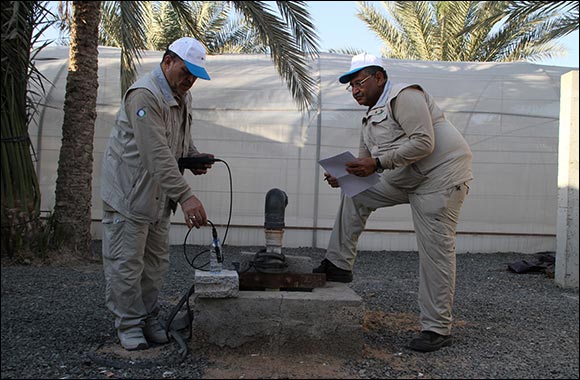
Field work is currently being carried out to fill the gaps, including conducting pumping experiments on several suitable wells to determine the hydraulic, permeability and storage parameters of underground aquifers in specific areas. Groundwater levels are measured, and samples are collected and tested to identify their chemical, biological and radiological properties.
The project’s outputs include preparing digital maps of the UAE with GIS and printing them on A0 sheets with different drawing scales. A booklet will be issued with each map that includes an explanation and interpretation of the map and additional information.
Other key outputs also include training national employees in EAD and enhancing their competency in map preparation, using the latest technologies, programmes and GIS, as well as the use of international standards, colours and legends in creating geological and hydrogeological maps.
Home >> Local News and Government Section
Emirates Aviation University marks 35 years of supporting the local and global aviation ecosystem
Music, Maps, and Stories at the Mohammed Bin Rashid Library in July
New SHEGLAM Daydreamer Mini Palette Turns Pocket-Sized into Power Pigment
Passenger Growth Hits 5% in May
João Almeida: Racing for Glory and Riding for the Team
May Air Cargo Demand Up 2.2% Despite Trade Disruptions
Return to Ritual: Celebrate Self-Care Month with BUFARMA Skincare
Rediscover family shopping days: REDTAG opens its doors in Al Ain
Dubai Culture Launches Open Call for 14th Sikka Art & Design Festival
Summer Restaurant Week Returns This DSS with Over 65 Exclusive Dining Deals Across Dubai
Julien Calloud Appointed CEO of SAVOYE to Lead a New Era of Performance and Innovation
Zoho Powers Up CRM for Everyone Platform with AI to Elevate Customer Experience
Media's Role in the Age of Algorithms By HH Sheikha Latifa bint Mohammed bin Rashid Al Maktoum
VinFast VF 8: The Premium Electric SUV Empowering a New Generation of Entrepreneurs in the UAE